
Image
by Mike Simms, Senior Curator of Natural Sciences
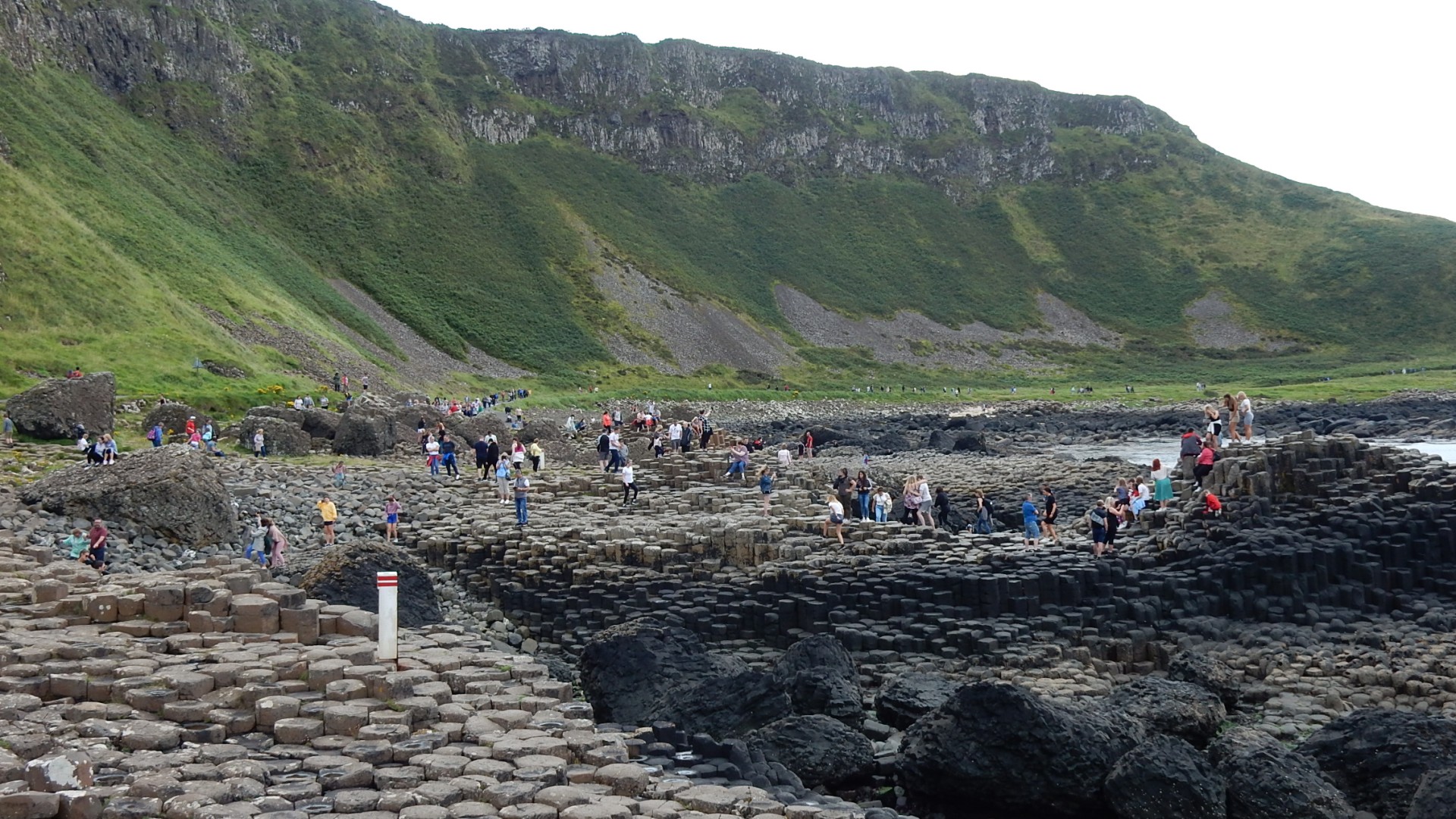
Millions of people have visited the Giant’s Causeway over the years and it is the most popular visitor attraction in all of Ireland, North or South. Among these visitors must have been many geologists, so surely there can be nothing radically new left to be discovered there. Yet a theory that has stood the test of time for more than 80 years, explaining why the remarkable columns are found down at sea-level only here, has been overturned following a remarkable new discovery.
Visitors in the 18th and 19th Centuries were puzzled by the amazing regularity of the columns and, inevitably, a myth grew up about a giant. His name escapes me… Another early theory, put forward by a certain Captain Morton, interpreted the stone columns as the petrified remains of giant bamboo stalks. Perhaps he should have gone to a well-known chain of opticians…
But we have known for more than a century now that these columns formed within a deep layer of molten lava erupted around 60 million years ago. As it slowly cooled and solidified, it shrank slightly to create the regular pattern of cracks we see today.
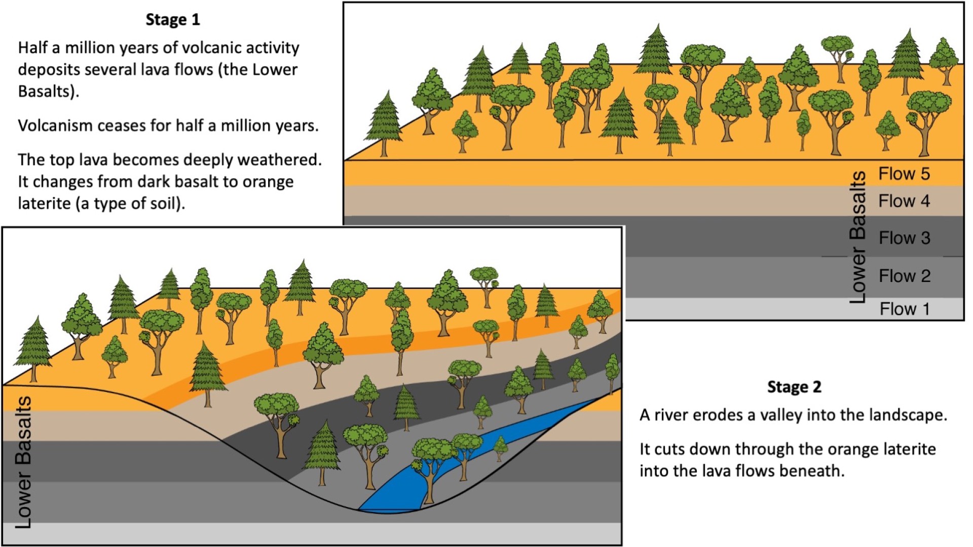
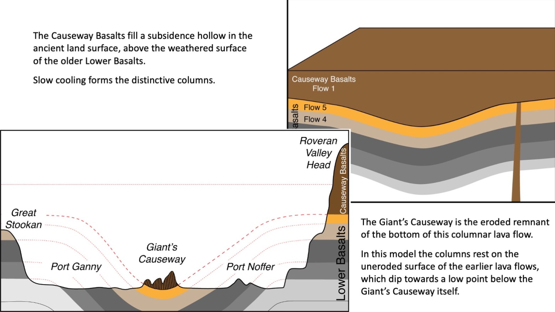
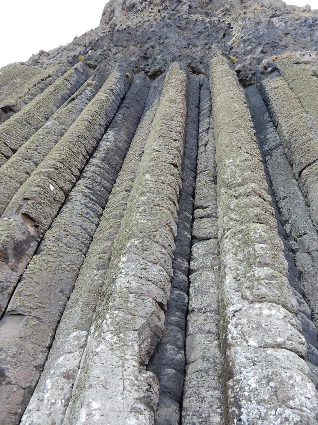
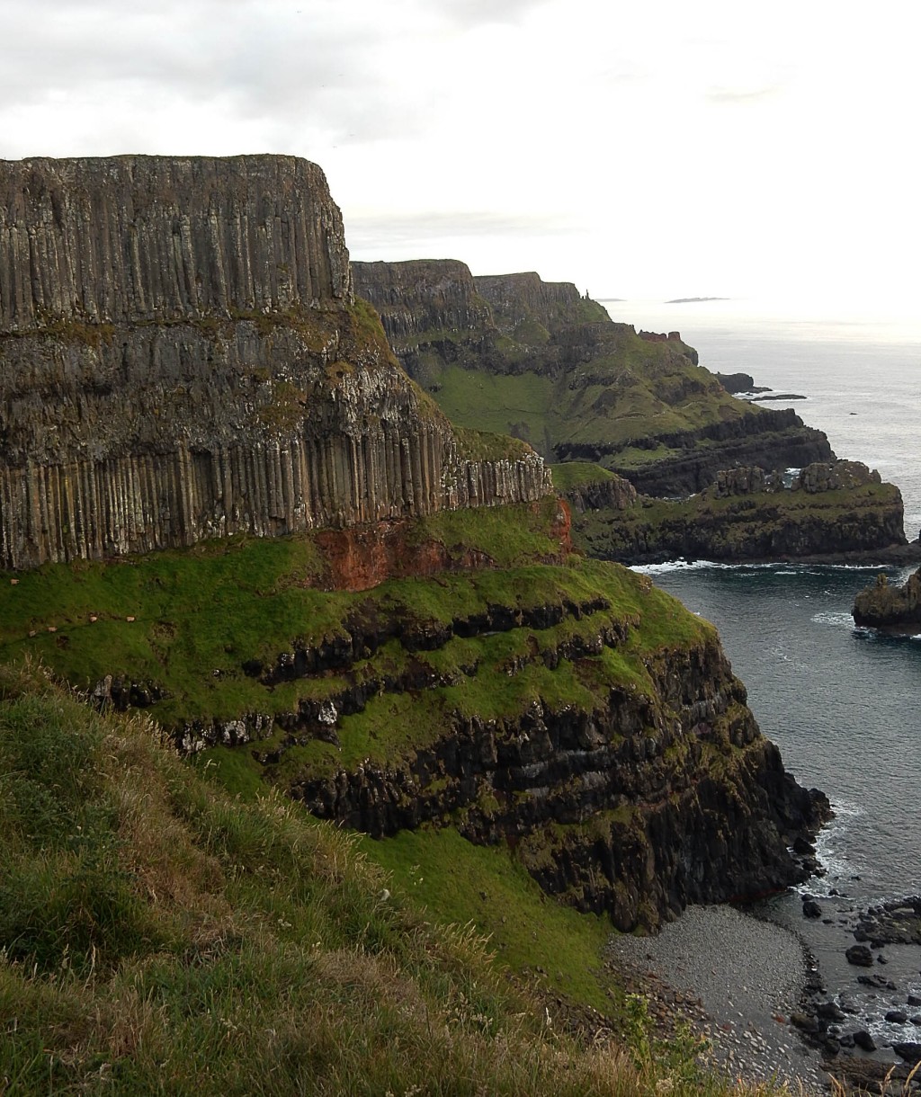
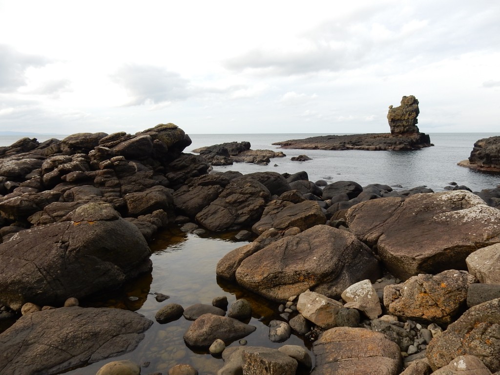
These columns can be seen in two or three thick layers of lava high in the cliffs all along the coast between Dunseverick Castle and the Giant’s Causeway. They lie above layers of older, darker, lava flows in the cliffs beneath and are separated from them by a bright orange band.
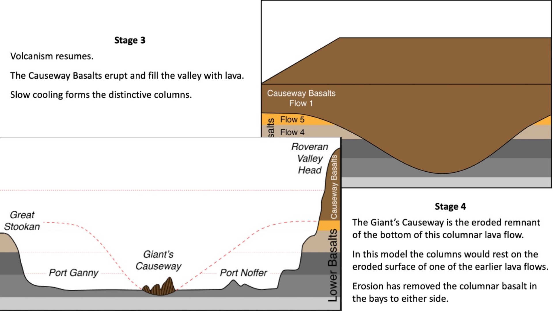
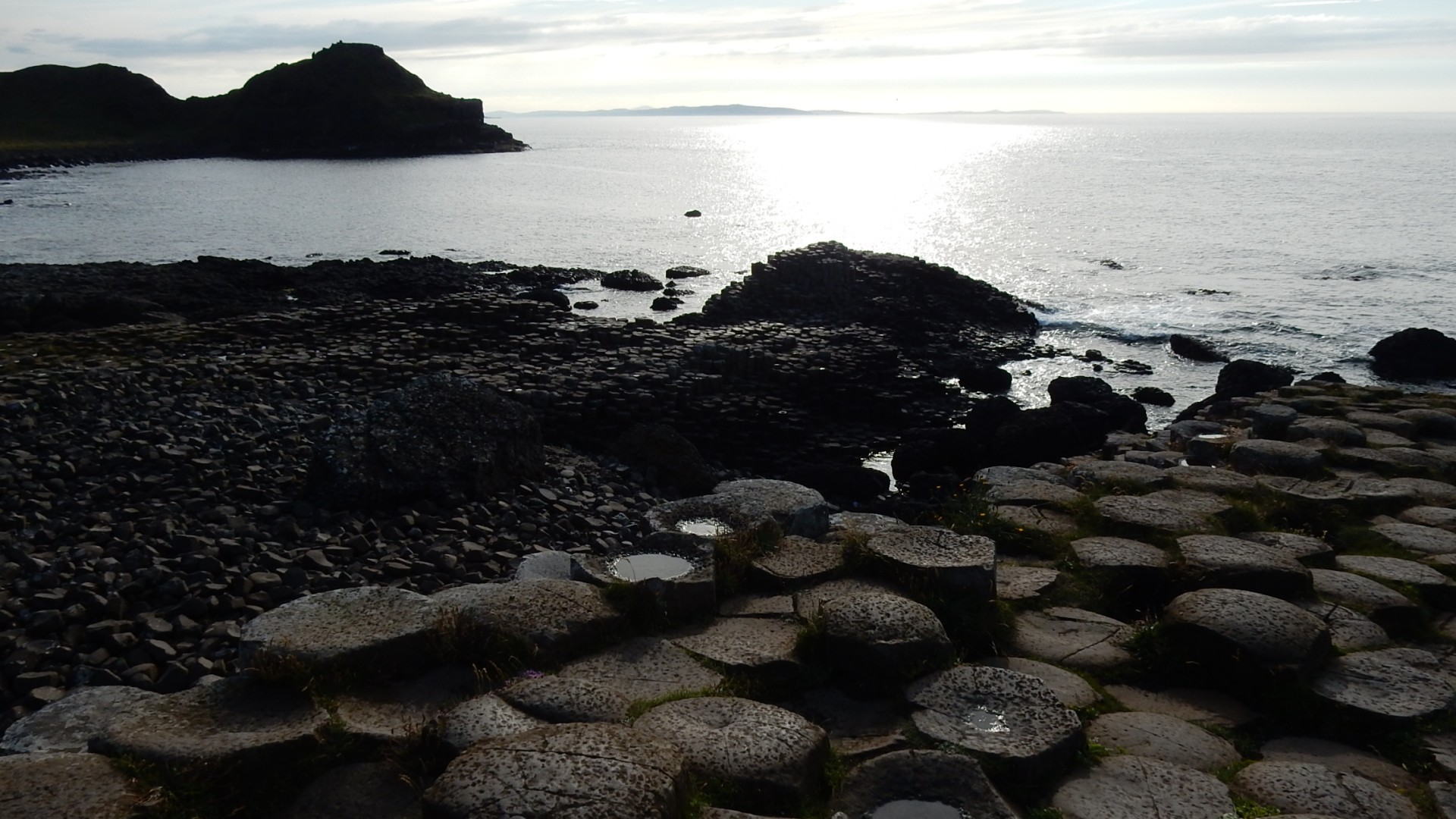
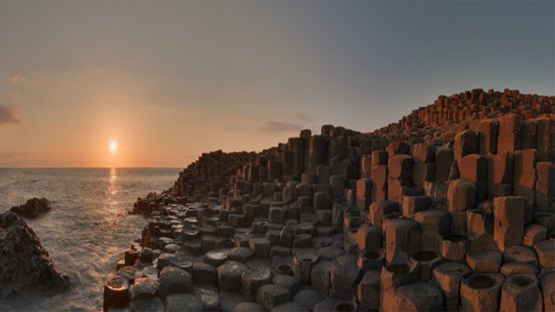
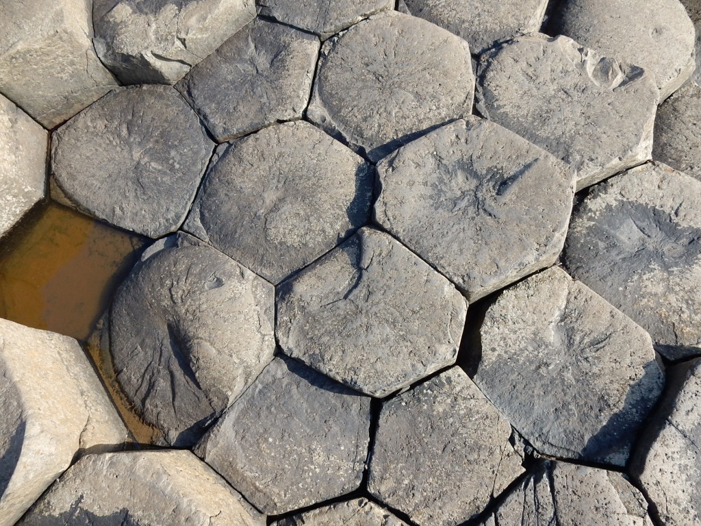
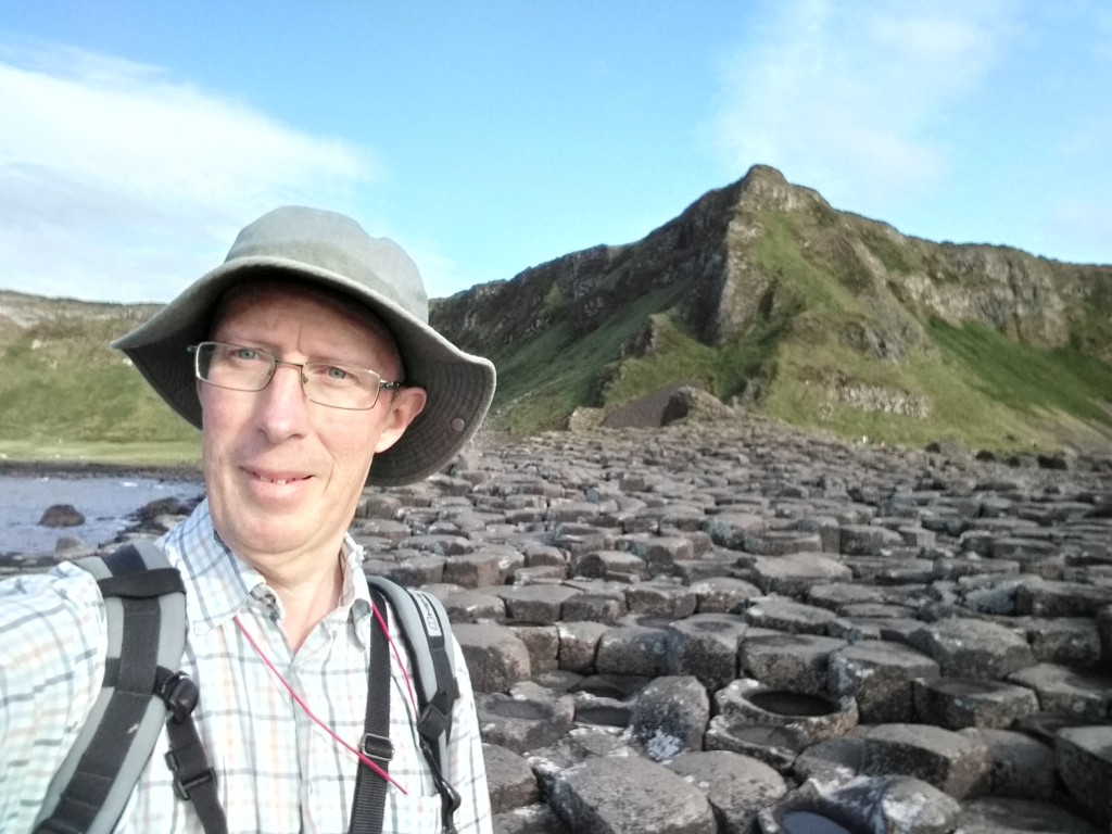
But at the Causeway itself, the lowest columnar lava flow is hugely thickened, to more than 70 metres, compared with about 20 metres on the headlands to the east and west. What we see today at the Giant’s Causeway is the eroded remnants of the bottom of this thick lava flow, over which visitors swarm like ants on a pile of sugar. But if the Causeway wasn’t built by that giant, then why do the columnar-jointed lavas come down to sea level here and nowhere else?
An ancient river valley
In 1940 a Lithuanian geologist by the name of Sergei Ivanovich Tomkeieff suggested that the lava that now forms the Giant’s Causeway had filled a deep river valley eroded into the older lava flows beneath. Supposedly this occurred during a long period of volcanic inactivity, perhaps lasting a few hundred thousand years, when the top of the previous lava flows weathered to form an iron-rich orange layer. He imagined that rivers flowed across the landscape during this time, eroding valleys through the weathered orange layer into the lava flows beneath.
It was an elegant theory indeed and went unchallenged for more than 80 years. Why should anyone doubt it? Surely there was nothing new to be discovered at the Giant’s Causeway. If there was, it would have been spotted long ago by all of those visiting geologists. But the river valley theory was wrong and the evidence was there for all to see.
On 19th August 2012 a small group of geologists, from as far afield as the USA, Japan and Brazil, were on a post-conference field trip to the Antrim coast. Standing below the spectacular columns of the Giant’s Organ, overlooking the Causeway itself, I explained Sergei’s theory about lava filling an ancient river valley carved into the landscape during that long period of volcanic quiescence. It was then that one of the Brazilian geologists piped up: “Would that be long enough to erode such a deep valley?” It was a question I had never considered before. Was it possible? I didn’t know, but his question triggered something else in my mind and the scales fell from my eyes. There in front of me, clear for all to see, was the evidence that Sergei Tomkeieff was wrong. But what could possibly be so obvious and yet overlooked for so long?
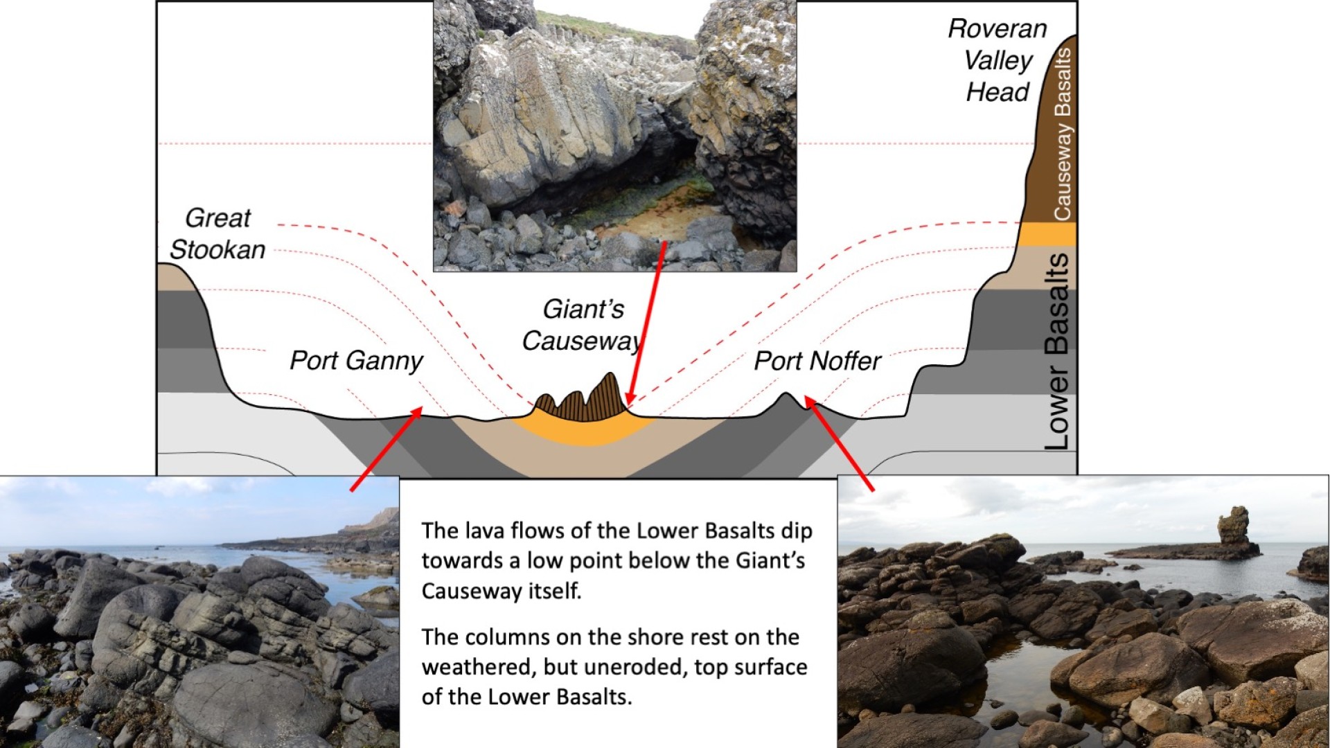
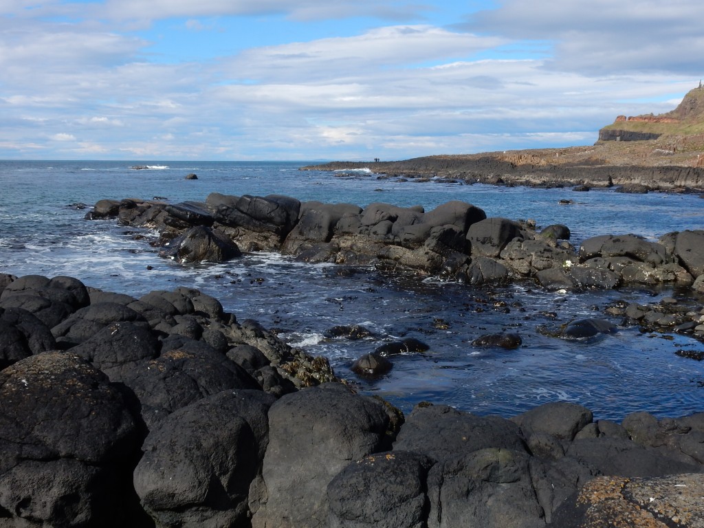
If a river had eroded down into that ancient landscape it would cut through the weathered orange layer into the horizontal layers of lava beneath. The rocks on the shore in Port Ganny and Port Noffer, to either side of the Causeway, would all lie on the same horizontal lava flow more than 50 metres below the top of the orange band, and the columns of the Causeway itself would also rest directly on this lava flow.
But they don’t. Even from a distance I could see immediately that the layers of lava exposed on the rocky shores in Port Ganny and Port Noffer were not horizontal. Instead, they sloped noticeably inwards towards the Causeway.
It suggested that instead of river erosion creating a valley, it was the ground that had subsided to form a hollow into which the Causeway lava had flowed and ponded.
An analogy that I find helpful to explain this involves cake. Eroding a river valley is rather like cutting through a layer cake to reveal the layers beneath the surface. But what we actually see is more like a badly-baked cake that has sunk in the middle.
This was a very exciting discovery, but I became distracted by other things. It was another five years before I returned to briefly check my theory and it was 2020 before I finally got around to investigating it properly.
Ah, 2020… The Year of The Plague. Stuck at home for weeks on end during lockdown, I wrote a short article outlining my findings and submitted it to a geological journal for publication. It was sent to other experts in the field for their opinions and they told me that I needed a lot more data to prove my case. There was only one way to address this, and that was to go to the Giant’s Causeway with my compass, clinometer and notebook, and gather some simple measurements from the rocks there.
Two trips there in June 2020 saw it almost deserted. At times I had the place to myself – a far cry from the usual Causeway honeypot. It was idyllic.
As I made my way across the shore taking notes and making measurements, it was clear that I was right. In places the older lava flows on the shore dip towards the Causeway at angles of more than 20o. More significantly, I found that the orange weathered layer that was visible high in the cliffs to east and west came down to the shore and passed right beneath the Giant’s Causeway. It had not been eroded away at all!
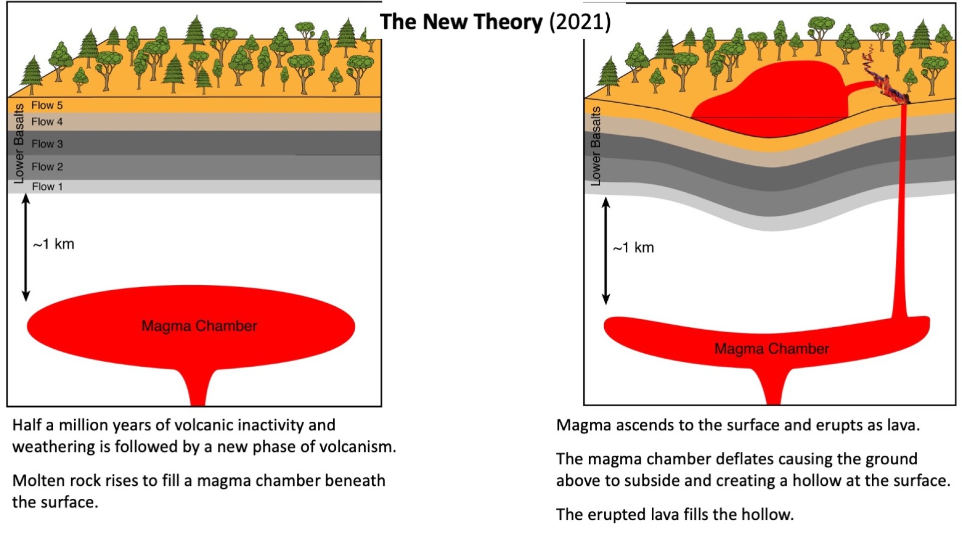
It was clear from this that the ground had subsided by as much as 50 or 60 metres, across a width of perhaps a kilometre, and that the Causeway lava then filled the hollow that had formed, creating ideal conditions for the amazing columns of the Giant’s Causeway to develop. The two events may well have been directly linked. Lava moving to the surface could have created a space beneath into which the ground subsided.
With all of this new data, I was able to draw up a detailed map and cross-section. The evidence suggests that the ground subsided as lava moved up from a magma chamber to erupt at the surface. This event took perhaps just a few days rather than the many thousands of years needed to erode a river valley. The result was the same, but the cause was very different.
Of course, this happened 60 million years ago in a landscape far removed from what we see today, and probably much more like the interior of Iceland than the present coastal setting. What was originally a hugely-thick, but flat-topped, pile of lava flows has since been eroded by glaciers and the sea into the bays of Port Noffer and Port Ganny separated by the resistant promontory of the Giant’s Causeway.
So why did it take so long for anyone to notice that the layers of lava beneath the Giant’s Causeway sloped inwards and that the hollow could not have been a river valley? I guess it was because everyone assumed that at such a well-known site there could be nothing new to discover. Sergei Tomkeieff’s ‘river valley’ model seemed to fit the existing narrative so well, with a long pause in volcanic activity allowing for weathering and erosion, that visiting geologists (me included) did not question it.
Like so many geologists before me I just went along with his interpretation and it was only a chance comment by a visitor that opened my eyes to other possibilities. The evidence for this new interpretation is far from subtle and it was hiding in plain sight all along. It shows how, even at such a well-known site as the Giant's Causeway, decades of apparent geological consensus can be overturned by just a moment of inspiration and a few simple field observations.